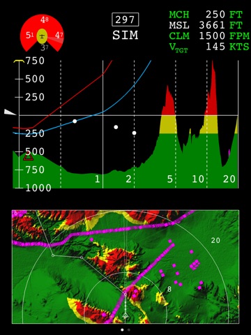

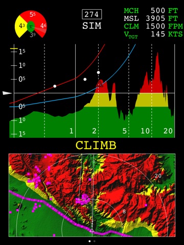
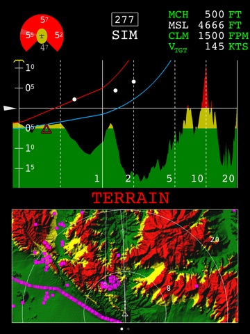

VerSA™ provides pilots with situational awareness to avoid Controlled Flight Into Terrain (CFIT) accidents. The display contains a moving map and terrain profile view with colored altitude banding based on the aircraft altitude and user selected Minimum Clearance Height. Based on user selected climb capability for the aircraft type, information is displayed about the aircraft energy (maximum and targeted climb rates and vertical flight trend) on the profile view. It is either standalone using the internal iPad GPS, or may be used with an external GPS.
This free VerSA download provides a simulated demonstration of the application capabilities. VerSA is a moving map application that requires digital terrain and obstacle data to operate. Jeppesen® (a Boeing company) terrain and obstacle data is licensed separately. Contact Boeing at [email protected].
This Application is for pilot situational awareness only and should not be used as the sole or primary means of accessing flight crew reference materials. VerSA may not be used where such use might interfere with the safe operation of the aircraft or is prohibited by applicable law.